3.11.2009
Google to Zap Earthquakes
>

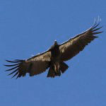
Google is going to make it easier to find earthquakes and pinpoint those annoying aftershocks that seemingly make California so hazardous on a minute-by-minute basis to people on the other side of the country. You never know when the "big one" is going to hit and all the land, say west of the Pinnacles National monument is going to splash into the ocean. The average Californian worries about this at least a couple times an hour, probably. The monument now has California condors flying around and it already did split in half, millions of years ago - the northern half of the Pinnacles floated up to Salinas, CA on the Pacific plate. The southern half of the Pinnacles is 195 miles south near Lancaster, California attached to the North American plate.

They're collaborating with the USGS in Menlo Park "science for a changing world" to make it so. No word on whether Beavis is going to be re-engaged to map the San Andreas Fault, after contract talks broke down a few years ago over terms of a potential deal that left Beavis feeling "insulted." Apparently, the backers balked at giving carbon-based life-form perquisites to an animated character.

They're collaborating with the USGS in Menlo Park "science for a changing world" to make it so. No word on whether Beavis is going to be re-engaged to map the San Andreas Fault, after contract talks broke down a few years ago over terms of a potential deal that left Beavis feeling "insulted." Apparently, the backers balked at giving carbon-based life-form perquisites to an animated character.
Labels: beavis, condor, neenach, usgs, volcano

